Humming planet reveals secrets of Paeroa Fault
Scientist are listening to the “hum of the Earth” with cutting-edge, low-cost devices to determine the seismic hazard of the Paeroa Fault.
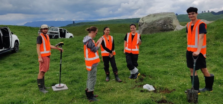
GNS research team in the field
The GNS research team installed 147 small seismometers in a targeted area south of Rotorua and used the earth’s natural rumbles to determine how steeply the seismic fault dives under its surface.
“If we know how deep the fault goes and on what angle, we can determine how big an area may rupture and what magnitude earthquakes it may trigger,” says geophysicist and project lead Dr Brook Keats, who explains that the instruments will detect small soundwaves to assess the structure of the fault.
“We listened to the hum of Earth, including the sounds of the waves crashing into the Bay of Plenty coast, just over 50km away, and measured the seismic velocity, or how fast the sound travels to different locations and at different depths,” says the GNS scientist.
The project team was funded by Natural Hazards Commission (NHC) Toka Tū Ake (previously EQC) and supported by the Australian National Seismic Imaging Resource (ANSIR), which is a research facility for earth sounding supplied the seismic instruments.
Keats explains that his project was one of the first in New Zealand to use the lunchbox-sized instruments that are not as sophisticated as the full-scale seismometers used by the GeoNet network but are cheap and easy to install – perfect for targeted studies like this one.
“So, in this case we went for quantity over quality and because we were able to install so many very quickly, we were able to overcome the quality issue by collecting so much data in just a month.”
NHC’s Head of Research, Dr Natalie Balfour, says the organisation invests in research that helps New Zealanders better understand and prepare for natural hazards.
“This research will provide a greater awareness of how big, and how often, the Paeroa Fault will rupture and will support local iwi, councils, communities and lifelines to prepare for these risks and build resilience.”
Keats says the team worked closely with local iwi Ngāti Tahu - Ngāti Whaoa and incorporated two local students as field assistants.
“They were fantastic to work with. And because the instruments were so easy to install, we could train them up quickly so they could help us install and collect the instruments,” says Keats, who adds that the team decided to pick the particular 5x5km location south of Rotorua because of its combination of volcanic, geothermal and seismic activity.
ENDS
NHC Toka Tū Ake media contact:
Nina Vidović
027 2261761 | media@naturalhazards.govt.nz
GNS Science media contact:
Ross Aaltonen
021 574 541 | media@gns.cri.nz
About the Natural Hazards Commission
The Natural Hazards Commission Toka Tū Ake exists to help New Zealanders prepare for and recover from the impact of natural hazards. One of the ways we do this is by providing natural hazards insurance for homes and residential land.
Homeowners have access to our scheme if they have an insurance policy with fire cover. The premium paid to insurers includes a Natural Hazards Insurance Levy, which is the amount homeowners pay for this cover.
You can find out more about Natural Hazards Cover/NHCover on our website to inform reporting on the issue.
You can also read more about our annual investment in research and resilience through regular updates on our news page.