Geology researcher finds clues to predict future landslides
New Zealand has experienced several high intensity rainfall events across regions of the North Island over the last few years. Heavy rainfall has caused landslides, accumulating billions of dollars of damage to buildings and infrastructure, and devastatingly, loss of life.
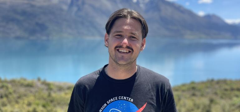
Harry John Le Cheminant
Researchers are looking for warning signs of these landslides, and which slopes are now at greater risk since these storm events.
Associate Professor Martin Brook’s research team at the University of Auckland is mapping ground movement in the Waitakere Ranges of Auckland using InSAR (Interferometric Synthetic Aperture Radar) techniques to create repeated, detailed images of the landscape to detect tiny changes over time.
Harry Le Cheminant, a master’s student in Brook’s team with real world consulting experience, used InSAR, high-resolution LiDAR (Light Detection and Ranging; using laser light to create 3D maps of the surface), and geomorphic field mapping (making a map of the Earth’s surface using observations of landforms and surface materials) to analyse pre- and post-storm slope changes, aiming to determine if there are hints that a landslide might happen before it does.
Having just wrapped on his master’s, Harry chatted to us as part of our Researcher profile series, were we showcase the people behind the research we fund. Outside of his research, Harry shares with us his passion for music and can be found – carrying out research down to the wire before jumping on a plane to LA to perform with his band.
What is your NHC funded project, in a nutshell, and why is it important to New Zealand?
The Natural Hazard Commission (NHC) funded master’s research investigated slowmoving landslides in the Waitākere Ranges, focusing on the coastal communities of Muriwai and Karekare. Using satellite-based Interferometric Synthetic Aperture Radar (InSAR), high-resolution LiDAR, and geomorphic field mapping, I examined the nature of slope deformation before and after extreme rainfall events such as the Auckland Anniversary Floods and Cyclone Gabrielle in 2023.
Rainfall-triggered landslides are one of New Zealand’s most damaging natural hazards therefore this research demonstrates how emerging monitoring tools can improve land use planning, building categorisation, and long-term landslide risk management.
What’s your favourite part of being a researcher?
What I value most about being a researcher is seeing how detailed analysis can inform real decisions. Working with InSAR and LiDAR data allowed me to identify subtle ground movements over large areas that aren’t visible at the surface, while the fieldwork helped verify and interpret the patterns.
I also enjoyed engaging with a wide range of scientific literature, which broadened my perspective on the scale of research being undertaken internationally and highlighted how emerging technologies are shaping applied hazard management. Collaborating closely with supervisors, specialists, and fellow researchers was a key highlight and reinforced the importance of teamwork in producing robust and meaningful research. Knowing that this work can support safer decision-making for communities exposed to landslide risk is incredibly rewarding.
How is your research helping make New Zealanders more resilient to natural hazards?
My research suggests that many landslides are preceded by slow, detectable ground movement rather than occurring without warning. By identifying unstable slopes earlier, tools such as InSAR can support more informed planning decisions, targeted monitoring, and clearer communication of risks associated through the use of visual outputs. Over time, this approach has the potential to reduce loss of life and property during extreme rainfall events.
Why is it important to invest in natural hazards research like yours?
Natural hazards already cost New Zealand billions of dollars and have devastating social impacts. With climate change increasing the frequency and intensity of extreme rainfall, landslide risk will only continue to grow. Through my consulting background, I’ve contributed to over 70 Natural Hazards Commission related assessments, which exposed me to the real-world challenges of mapping landslides, assessing slope deformation, and producing technical information that may be considered to aid future planning and policy decisions. That experience highlighted both the strengths and limitations of current approaches.
Investing in research allows us to move beyond reactive disaster response and refine how hazards are identified, monitored, and managed. Advances in technologies such as InSAR and LiDAR provide opportunities to better detect slope instability, inform evidence-based policy, and support more proactive, risk-informed decision-making
What are your ambitions for further research or career after your studies?
I plan to continue working in the consulting industry, building on around five years of experience in engineering geology. My goal is to further specialise in slope stability and remote sensing, applying tools such as InSAR and LiDAR to support hazard assessment, land-use planning, and risk-informed decision-making for councils, infrastructure providers, and communities.
Looking ahead, I’m also interested in how emerging InSAR processing approaches such as advanced phase-linking techniques could improve deformation monitoring in challenging environments like steep, vegetated terrain, helping extend the practical use of these tools in applied hazard management.
What’s one finding from your research that you wish more people knew about?
A key finding from my research is that many landslides are preceded by measurable, slow ground deformation rather than occurring without warning. In several locations, PS-InSAR time-series data showed sustained movement months to years before failure. This highlights the value of long-term deformation monitoring, particularly when combined with advances in automation and machine learning to improve the efficiency and timeliness of InSAR processing. In the future, these approaches could help prioritise areas already showing deformation and integrate them with region-specific rainfall thresholds.
Longstanding InSAR deformation models could help identify locations more prone to evacuation and inundation-related land damage, supporting earlier alerts and more informed decision-making by councils and emergency managers when coupled with meteorological forecasting systems such as those used by MetService, provided local geological conditions and triggering mechanisms are well understood.
Do you have a favourite anecdote or memory related to your research?
One moment that stands out was producing the final InSAR timeseries results for Karekare after weeks of late nights and failed processing runs. The steep, vegetated terrain made the analysis particularly challenging, and collaboration with InSAR specialists and PhD researchers was critical to resolving those issues. The experience culminated in submitting my thesis under a very tight deadline, prior to flying to Los Angeles later that same day to perform on the Sunset Strip, which made the achievement feel all the more memorable.
What do you like to do for fun outside of work/study?
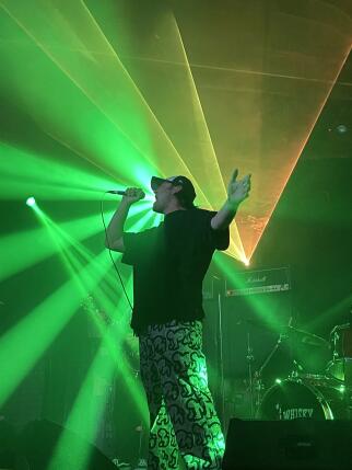 Outside of geology, music has been a major part of my life for over 16 years. I’m a singer and multi-instrumentalist and am part of two internationally recognised bands. Moon Monsoon began in Dunedin during my undergraduate Bachelor of Science in Geology (2016), with the release of our debut EP, which has accumulated over 20 million streams worldwide.
More recently, the project Th’ Goodside has grown internationally. In 2024, we won first place in New Zealand’s National Battle of the Bands, which led to an opportunity to travel to the United States to perform at the Whisky a Go Go in Los Angeles and record our debut album at the iconic Rancho De La Luna studio in Joshua Tree. Music is a creative outlet that helps me recharge and connect with community.